 |
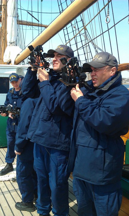
| USCG Cadets using the sextant |
The point that caught my eye was the article about Ex-Meridians which included remarks about Amplitudes. This Post is not meant to be critical (well maybe just a little bit) of the Article titled "Ex-Meridians for USCG exams" but to show the difference between today's OOW/navigator, who apparently uses Celestial Navigation only as means to check his/her electronic wonderland of a Bridge, to my generation of Navigators which used Celestial Navigation to navigate the oceans worldwide - well and safely too.
The writer states quote: "This topic is beyond the scope of even what we normally teach as "advanced celestial navigation". However esoteric though it is, it shows up on USCG licensing exams for 1600 ton Mate Oceans and above".
He further goes on to describe an Amplitude: "which is basically useless"
Yet further on Ex-Meridian's he states: "no modern navigator worthy of the name would ever use the ex-meridian sight".
Ouch! Now that hurt my 60 years experience.
How things change and professionally maybe not for the better. When NAUTICAL LOG served in the British Merchant Navy there was a daily procedure for the Navigation Day's Work (similar to USN refer OPNAV 3530/1 and 30-44). The Navigator was usually the 2nd. Officer, however passenger vessel rankings were slightly different.
The day at sea ran from Noon to Noon and the Noon (LAN) Sight was a Merchant Navy religious event with several Officers all with their personal sextants lined up on the Bridge wing to watch the sun reach its highest point. Once this had been agreed upon, if the Master was in attendance his "that seems to be it gentleman" indicated the Latitude should be quickly calculated, the savvy Navigator having worked up his 'magic number' ahead of time, immediately stated the Latitude, the Longitude was run-up, the Noon position for that day, distance, the days run average speed, ETA to next Port all calculated. Other than the OOW the Bridge Party could then retire to the Masters Dayroom for a gin before lunch.
How was all this arrived at - by that daily procedure. The morning star sight and Amplitude were taken by the 0400-0800 OOW, the morning sunline and azimuth by the 0800-1200 OOW, Noon Sight (LAN) by all Deck Officers, afternoon sunline and azimuth by the 1200-1600 OOW, and evening star sight and Amplitude by 1600-2000 OOW. The Amplitudes gave an instant compass error confirming the working of those Azimuths. Now do you still think an Amplitude is "basically useless" - not for my generation of Navigators.
But what about the Ex-Meridian which started out this Article. If the Navigator saw that the Noon Bridge Party was going to be disappointed because of cloud cover or rain he would get an Ex-Meridian so as to have a quite decent Noon Position to give to the Master - and perhaps get a gin at the same time. If there had been no luck before LAN then maybe after and see how that compared with the Latitude chosen for Noon Position.
Personally NAUTICAL LOG privately used the Stars to Stars positions for all navigational calculations and based answers to the Master's questions on that information. A personal preference that worked out well over the years.
"Touch upon all the arts."
Good Watch
There remain some 400 of our fellow seafarers held captive by pirates off Somalia. Lets us continue to work for their release.
Comments